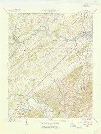
1939 Map of Bluff City
USGS Topo · Published 1954About this map
South Fork Holston River and the Watauga River converge in this Upper East Tennessee landscape, defining the local geography and economy of the late 1930s. The bustling settlement of Bluff City sits along the riverbank, supported by the Southern railroad line and nearby industry like Galloway Mill. This survey captures a rural network of family and community life, marked by numerous small schools and churches such as Buffalo School and Holston Grove Church.
Find a feature on this map
88 named features on this map. Tap any name to fly to it.
Don’t see what you’re looking for? This feature index may not catch every label — zoom into the map to look around manually.
Map Details
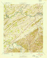
Editions of this 1939 Bluff City Map
2 editions found
Other maps of this area

1891 · Roan Mountain
USGS Topo · 1:125,000

1894 · Roan Mountain
USGS Topo · 1:125,000

1897 · Bristol
USGS Topo · 1:125,000

1902 · Bristol
USGS Topo · 1:125,000

1904 · Roan Mountain
USGS Topo · 1:125,000

1934 · Bristol
USGS Topo · 1:24,000

1935 · Watauga Valley
USGS Topo · 1:48,000

1935 · Blountville
USGS Topo · 1:24,000
1935 · Beaver Creek
USGS Topo · 1:48,000

1935 · Spurgeon
USGS Topo · 1:24,000