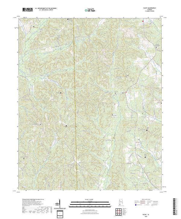
2024 Map of Bluff
USGS Topo · Published 2024About this map
The boundary between Lamar Co and Fayette Co divides this rural landscape, which is defined by a dense network of creek valleys and community-centered landmarks. Near the small settlement of Bluff, the terrain is punctuated by numerous family and community burial grounds, including Powell Cem and Holliman Cem. The spiritual life of the area is anchored by established congregations such as the Antioch Baptist Church and the Old Union Primitive Baptist Church, both of which maintain associated cemeteries that are invaluable for genealogical research.
Find a feature on this map
90 named features on this map. Tap any name to fly to it.
Don’t see what you’re looking for? This feature index may not catch every label — zoom into the map to look around manually.
Map Details
Editions of this 2024 Bluff Map
This is the sole edition of this map. No revisions or reprints were ever made.
Other maps of this area

1953 · Birmingham
USGS Topo · 1:250,000

1953 · West Point
USGS Topo · 1:250,000

1956 · Birmingham
USGS Topo · 1:250,000

1957 · Birmingham
USGS Topo · 1:250,000

1958 · West Point
USGS Topo · 1:250,000

1963 · West Point
USGS Topo · 1:250,000

1967 · Winfield SE
USGS Topo · 1:24,000

1967 · Beaverton
USGS Topo · 1:24,000

1967 · Hightogy
USGS Topo · 1:24,000

1967 · Bluff
USGS Topo · 1:24,000