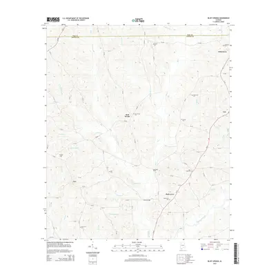
2014 Map of Bluff Springs
USGS Topo · Published 2014About this map
Bluff Springs and surrounding Coffee County communities appear in high detail in this modern survey, which traces the intricate drainage patterns of Whitewater Creek and its many tributaries. The area is characterized by a high density of rural burial grounds, including Zions Chapel Cem, Clay Hill Cem, and Old Sharron Cem, which serve as vital landmarks for local genealogical research. Historically significant crossing points like Lewis Mill Bridge and Thames Bridge over Big Cr indicate the long-standing transport network connecting settlements like Jack and Wilkinstown. The landscape is dominated by the ridges surrounding Coston Hill, with a network of county roads such as Al-87 and Church St weaving through the hills to reach isolated churches and small settlements like Zoar and Shady Grove.
Find a feature on this map
80 named features on this map. Tap any name to fly to it.
Don’t see what you’re looking for? This feature index may not catch every label — zoom into the map to look around manually.
Map Details
Editions of this 2014 Bluff Springs Map
This is the sole edition of this map. No revisions or reprints were ever made.
Other maps of this area

1942 · Enterprise
USGS Topo · 1:125,000

1948 · Brundidge
USGS Topo · 1:62,500

1950 · Enterprise
USGS Topo · 1:62,500

1950 · Brundidge
USGS Topo · 1:62,500

1953 · Andalusia
USGS Topo · 1:250,000

1953 · Dothan
USGS Topo · 1:250,000

1954 · Dothan
USGS Topo · 1:250,000

1955 · Dothan
USGS Topo · 1:250,000

1957 · Andalusia
USGS Topo · 1:250,000

1960 · Victoria
USGS Topo · 1:24,000