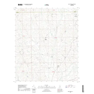
2018 Map of Bluff Springs
USGS Topo · Published 2018About this map
Bluff Springs sits at the heart of this landscape where the Pike and Coffee county line divides the northern reaches. The area is defined by a dense network of watercourses including Bluff Creek, Cowpen Creek, and Stinking Creek, which drain the low ridges and create the many branches and pridgeons that carve the terrain. Small settlements like Jack and Wilkinstown are connected by a rural road system that follows the natural rises, avoiding the wetland areas around Jackson Pond. For local historians and genealogists, the map reveals the placement of several community centers and burial grounds, such as Zions Chapel Cemetery and Mount Hebron Cemetery, indicating the dispersed but established social fabric of this part of Alabama. Notable landmarks such as Lewis Mill Bridge and Thames Bridge suggest historical crossing points over the winding creeks that have shaped the local movement and economy.
Find a feature on this map
83 named features on this map. Tap any name to fly to it.
Don’t see what you’re looking for? This feature index may not catch every label — zoom into the map to look around manually.
Map Details
Editions of this 2018 Bluff Springs Map
This is the sole edition of this map. No revisions or reprints were ever made.
Other maps of this area

1942 · Enterprise
USGS Topo · 1:125,000

1948 · Brundidge
USGS Topo · 1:62,500

1950 · Enterprise
USGS Topo · 1:62,500

1950 · Brundidge
USGS Topo · 1:62,500

1953 · Andalusia
USGS Topo · 1:250,000

1953 · Dothan
USGS Topo · 1:250,000

1954 · Dothan
USGS Topo · 1:250,000

1955 · Dothan
USGS Topo · 1:250,000

1957 · Andalusia
USGS Topo · 1:250,000

1960 · Victoria
USGS Topo · 1:24,000