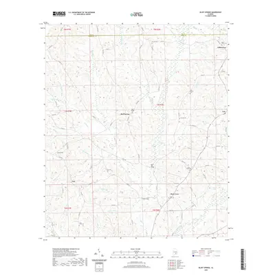
2020 Map of Bluff Springs
USGS Topo · Published 2020About this map
Bluff Springs and the surrounding rural landscapes of Coffee and Pike counties are defined by a network of creeks and small family cemeteries. The terrain is marked by notable elevations such as Coston Hill and an intricate drainage system including the E Fork Stinking Cr, Sweetwater Cr, and Whitewater Creek. Infrastructure like the Lewis Mill Bridge and Thames Bridge indicates historical crossing points across these waterways, serving the small settlements of Wilkinstown, Zoar, and Shady Grove. Genealogists will find significant value in the numerous burial sites documented across the quadrangle, including Zions Chapel Cem, Old Sharron Cem, and Mount Hebron Cem. This survey illustrates a quiet, agricultural pocket of Alabama where many place names are tied directly to local water bodies and prominent hills.
Find a feature on this map
83 named features on this map. Tap any name to fly to it.
Don’t see what you’re looking for? This feature index may not catch every label — zoom into the map to look around manually.
Map Details
Editions of this 2020 Bluff Springs Map
This is the sole edition of this map. No revisions or reprints were ever made.
Other maps of this area

1942 · Enterprise
USGS Topo · 1:125,000

1948 · Brundidge
USGS Topo · 1:62,500

1950 · Enterprise
USGS Topo · 1:62,500

1950 · Brundidge
USGS Topo · 1:62,500

1953 · Andalusia
USGS Topo · 1:250,000

1953 · Dothan
USGS Topo · 1:250,000

1954 · Dothan
USGS Topo · 1:250,000

1955 · Dothan
USGS Topo · 1:250,000

1957 · Andalusia
USGS Topo · 1:250,000

1960 · Victoria
USGS Topo · 1:24,000