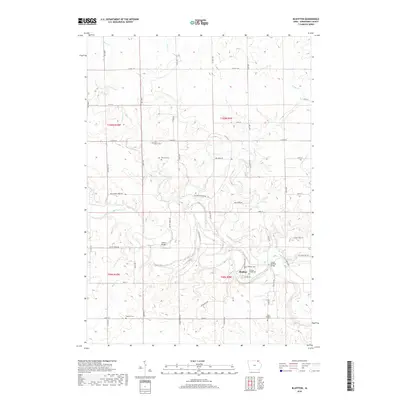
2018 Map of Bluffton
USGS Topo · Published 2018About this map
The Upper Iowa River carves a winding path through this corner of Winneshiek County, centering on the small settlement of Bluffton. This 2018 survey reveals a landscape deeply connected to its rural cemeteries and historic crossing points. Genealogists will find several burial sites preserved across the township lines, including Saint Agnes Cem, Metcalf Cem, and Baethke Cem, as well as both the Bluffton Cem and the Bluffton Village Cem located near the town center. The transportation network is defined by traditional river crossings such as the Gilliece Bridge and the Lower Bluffton Bridge, which connect various county roads including Co Hwy A14 and Chimney Rock Rd. Significant tributaries like Cold Water Cr and Pine Cr feed into the main river valley, illustrating the complex drainage patterns of this northeastern Iowa terrain.
Find a feature on this map
54 named features on this map. Tap any name to fly to it.
Don’t see what you’re looking for? This feature index may not catch every label — zoom into the map to look around manually.
Map Details
Editions of this 2018 Bluffton Map
This is the sole edition of this map. No revisions or reprints were ever made.
Other maps of this area

1906 · Decorah
USGS Topo · 1:125,000

1954 · Mason City
USGS Topo · 1:250,000

1957 · Mason City
USGS Topo · 1:250,000

1958 · Mason City
USGS Topo · 1:250,000

1958 · La Crosse
USGS Topo · 1:250,000

1961 · La Crosse
USGS Topo · 1:250,000

1965 · La Crosse
USGS Topo · 1:250,000

1965 · Harmony
USGS Topo · 1:24,000

1965 · Mabel
USGS Topo · 1:24,000

1965 · Canton
USGS Topo · 1:24,000