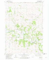
1981 Map of Bluffton
USGS Topo · Published 1982About this map
The Upper Iowa River winds through this corner of Winneshiek County, carving a deep valley through the limestone bluffs of northeastern Iowa. In the early 1980s, this landscape was defined by a balance of agricultural plateaus and protected natural areas, including the Bluffton Fir Stand State Preserve and the Cold Water Springs State Wildlife Area. The small settlement of Bluffton sits tucked within a sharp bend of the river, while Kendallville serves the western edge of the quadrangle.
Find a feature on this map
29 named features on this map. Tap any name to fly to it.
Don’t see what you’re looking for? This feature index may not catch every label — zoom into the map to look around manually.
Map Details
Editions of this 1981 Bluffton Map
This is the sole edition of this map. No revisions or reprints were ever made.
Other maps of this area

1906 · Decorah
USGS Topo · 1:125,000

1954 · Mason City
USGS Topo · 1:250,000

1957 · Mason City
USGS Topo · 1:250,000

1958 · Mason City
USGS Topo · 1:250,000

1958 · La Crosse
USGS Topo · 1:250,000

1961 · La Crosse
USGS Topo · 1:250,000

1965 · La Crosse
USGS Topo · 1:250,000

1965 · Harmony
USGS Topo · 1:24,000

1965 · Mabel
USGS Topo · 1:24,000

1965 · Canton
USGS Topo · 1:24,000