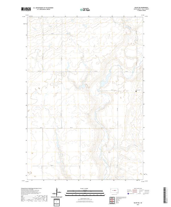
2021 Map of Blunt NE
USGS Topo · Published 2021About this map
Medicine Knoll Creek meanders through this portion of Sully County, cutting a winding path across the landscape northeast of Blunt. The terrain is defined by the drainage patterns of Medicine Knoll Cr and its various unnamed tributaries, which have carved shallow draws into the prairie. Settlement is sparse, characterized by a regular grid of section-line roads such as 316th Ave and E Onida Rd.
Find a feature on this map
20 named features on this map. Tap any name to fly to it.
Don’t see what you’re looking for? This feature index may not catch every label — zoom into the map to look around manually.
Map Details
Editions of this 2021 Blunt NE Map
This is the sole edition of this map. No revisions or reprints were ever made.
Other maps of this area

1953 · Huron
USGS Topo · 1:250,000

1954 · Huron
USGS Topo · 1:250,000

1967 · Blunt
USGS Topo · 1:24,000

1967 · Blunt SE
USGS Topo · 1:24,000
1967 · Blunt NW
USGS Topo · 1:24,000

1967 · Blunt NE
USGS Topo · 1:24,000

1968 · Harrold NW
USGS Topo · 1:24,000

1968 · Harrold
USGS Topo · 1:24,000

1974 · Gettysburg Municipal Airport SE
USGS Topo · 1:24,000
1974 · Gettysburg Municipal Airport SW
USGS Topo · 1:24,000