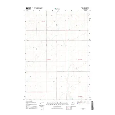
2015 Map of Blunt NW
USGS Topo · Published 2015About this map
The rolling plains of Sully County are defined by a strict section-line grid in this 2015 U.S. Geological Survey topographic study. Situated northwest of Blunt, the landscape is almost entirely organized around agricultural access, with north-south roads like 311th Ave and east-west thoroughfares such as 183rd St and 190th St carving the prairie into neat squares. This systematic layout is typical of the Great Plains' development, where the Public Land Survey System dictated the location of every farmhouse and field access point.
Find a feature on this map
22 named features on this map. Tap any name to fly to it.
Don’t see what you’re looking for? This feature index may not catch every label — zoom into the map to look around manually.
Map Details
Editions of this 2015 Blunt NW Map
This is the sole edition of this map. No revisions or reprints were ever made.
Other maps of this area

1953 · Huron
USGS Topo · 1:250,000

1954 · Pierre
USGS Topo · 1:250,000

1954 · Huron
USGS Topo · 1:250,000

1958 · Pierre
USGS Topo · 1:250,000

1965 · Agar
USGS Topo · 1:24,000

1967 · Onida SE
USGS Topo · 1:24,000

1967 · Blunt
USGS Topo · 1:24,000

1967 · Blunt SE
USGS Topo · 1:24,000
1967 · Blunt NW
USGS Topo · 1:24,000

1967 · Blunt NE
USGS Topo · 1:24,000