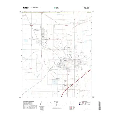
2020 Map of Blytheville
USGS Topo · Published 2020About this map
Chickasawba Mound rises above the flat Delta terrain, serving as a prominent landmark in a landscape defined by an extensive drainage network including Ditch Number 46 and Ditch Number 29. This survey captures the core of Blytheville, showcasing the Mississippi County Blytheville Courthouse and the nearby community of Chickasawba. The integration of civil and military history is evident through the presence of the Arkansas International Airport and its proximity to Gosnell. Farther out, the rural character is preserved in smaller settlements like Dogwood Ridge and Calumet. Genealogists will find a wealth of burial sites across the quadrangle, from the centrally located Maple Grove Cem and Elmwood Cem to more outlying locations like Mount Zion Cem and Hatcher Cem, tracing the settlement patterns of this Mississippi County region.
Find a feature on this map
72 named features on this map. Tap any name to fly to it.
Don’t see what you’re looking for? This feature index may not catch every label — zoom into the map to look around manually.
Map Details
Editions of this 2020 Blytheville Map
This is the sole edition of this map. No revisions or reprints were ever made.
Other maps of this area

1934 · Kennett
USGS Topo · 1:62,500

1939 · Blytheville
USGS Topo · 1:62,500

1940 · Kennett
USGS Topo · 1:62,500

1940 · Hayti
USGS Topo · 1:62,500

1941 · Manila
USGS Topo · 1:62,500

1953 · Memphis
USGS Topo · 1:250,000

1955 · Hayti
USGS Topo · 1:62,500

1955 · Blytheville
USGS Topo · 1:62,500

1956 · Kennett
USGS Topo · 1:62,500

1956 · Manila
USGS Topo · 1:62,500