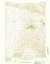
1958 Map of Boars Tusk
USGS Topo · Published 1967About this map
Boars Tusk rises as a prominent landmark in this 1950s survey of the high desert landscape north of Rock Springs. The map documents a period of early resource extraction and ranching across the North Baxter Basin, where scattered Oil Wells, a Gas Well, and the Chilton Mine sit alongside historic homestead sites. The geography is defined by the Continental Divide and dramatic volcanic and sedimentary formations including North Table Mtn, South Table Mtn, and the expansive Sand Dunes.
Find a feature on this map
30 named features on this map. Tap any name to fly to it.
Don’t see what you’re looking for? This feature index may not catch every label — zoom into the map to look around manually.
Map Details
Editions of this 1958 Boars Tusk Map
2 editions found
Other maps of this area

1908 · Rock Springs
USGS Topo · 1:62,500

1910 · Rock Springs
USGS Topo · 1:62,500

1954 · Rock Springs
USGS Topo · 1:250,000

1955 · Lander
USGS Topo · 1:250,000

1958 · Lander
USGS Topo · 1:250,000

1958 · Rock Springs
USGS Topo · 1:250,000

1958 · Essex Mountain
USGS Topo · 1:62,500

1958 · Boars Tusk
USGS Topo · 1:62,500

1958 · Freighter Gap
USGS Topo · 1:62,500

1958 · Superior
USGS Topo · 1:62,500