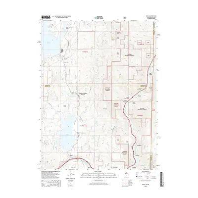
2015 Map of Boca
USGS Topo · Published 2015About this map
Boca Reservoir and the Little Truckee River corridor define this landscape along the California-Nevada state line, where the high Sierra terrain transitions toward the Truckee River canyon. The map documents a critical water management landscape, dominated by large impoundments including the Stampede Reservoir and the smaller Boca Reservoir to the south. Historically, this area served as a vital transportation and industrial artery, evidenced by the string of settlements along the Truckee River including Floriston, Bronco, and Iceland. These locales reflect the region's legacy of rail-side industry and seasonal ice harvesting. The rugged topography is marked by significant elevations like Verdi Peak and Granite Peak within the Tahoe National Forest and Toiyabe National Forest. Collectors and local historians can trace the old road alignments such as Dog Valley Rd and Hobart Mills Rd, which once connected these mountain outposts to the broader timber and rail networks of the 19th and 20th centuries.
Find a feature on this map
60 named features on this map. Tap any name to fly to it.
Don’t see what you’re looking for? This feature index may not catch every label — zoom into the map to look around manually.
Map Details
Editions of this 2015 Boca Map
This is the sole edition of this map. No revisions or reprints were ever made.
Other maps of this area

1890 · Sierraville
USGS Topo · 1:125,000

1891 · Carson
USGS Topo · 1:125,000

1891 · Truckee
USGS Topo · 1:125,000

1891 · Reno
USGS Topo · 1:125,000

1892 · Sierraville
USGS Topo · 1:125,000

1893 · Carson
USGS Topo · 1:125,000

1893 · Truckee
USGS Topo · 1:125,000

1893 · Reno
USGS Topo · 1:125,000

1894 · Sierraville
USGS Topo · 1:125,000

1895 · Truckee
USGS Topo · 1:125,000