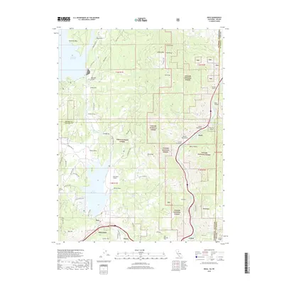
2018 Map of Boca
USGS Topo · Published 2018About this map
The Little Truckee River and Truckee River converge in this high-altitude landscape where the Tahoe National Forest meets the Toiyabe National Forest. The 2018 survey illustrates a complex network of recreational and access routes, including the Little Boca Loop and numerous off-highway vehicle paths like the Big Boca OHV and Lake Front OHV. Large-scale water management is central to the area, dominated by the Boca Reservoir and the southern reaches of Stampede Reservoir.
Find a feature on this map
72 named features on this map. Tap any name to fly to it.
Don’t see what you’re looking for? This feature index may not catch every label — zoom into the map to look around manually.
Map Details
Editions of this 2018 Boca Map
This is the sole edition of this map. No revisions or reprints were ever made.
Other maps of this area

1890 · Sierraville
USGS Topo · 1:125,000

1891 · Carson
USGS Topo · 1:125,000

1891 · Truckee
USGS Topo · 1:125,000

1891 · Reno
USGS Topo · 1:125,000

1892 · Sierraville
USGS Topo · 1:125,000

1893 · Carson
USGS Topo · 1:125,000

1893 · Truckee
USGS Topo · 1:125,000

1893 · Reno
USGS Topo · 1:125,000

1894 · Sierraville
USGS Topo · 1:125,000

1895 · Truckee
USGS Topo · 1:125,000