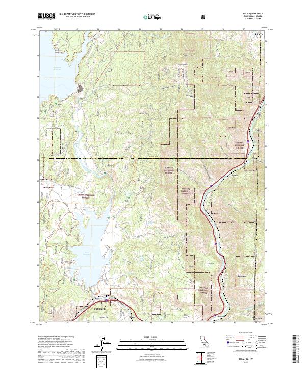
2022 Map of Boca
USGS Topo · Published 2022About this map
The Little Truckee River and the main stem of the Truckee River define the movement through this high-altitude landscape on the California-Nevada border. This area is anchored by the large impoundments of Stampede Reservoir and Boca Reservoir, which submerged earlier valley floors like Stampede Valley and Russel Valley. Small rail-side settlements and historical stopovers such as Boca, Hinton, and Iceland sit along the river corridor, reflecting a long history of water management and transportation through the Verdi Range. The terrain is characterized by steep canyons and prominent summits, including Granite Peak and Ladybug Peak. Numerous specialized tracks, such as the Boca Atv Tie Trl and Ladybug Jeep Trl, crisscross the Tahoe National Forest and Toiyabe National Forest, illustrating the modern transition of this mountain territory from an industrial corridor to a center for backcountry recreation.
Find a feature on this map
73 named features on this map. Tap any name to fly to it.
Don’t see what you’re looking for? This feature index may not catch every label — zoom into the map to look around manually.
Map Details
Editions of this 2022 Boca Map
This is the sole edition of this map. No revisions or reprints were ever made.
Other maps of this area

1890 · Sierraville
USGS Topo · 1:125,000

1891 · Carson
USGS Topo · 1:125,000

1891 · Truckee
USGS Topo · 1:125,000

1891 · Reno
USGS Topo · 1:125,000

1892 · Sierraville
USGS Topo · 1:125,000

1893 · Carson
USGS Topo · 1:125,000

1893 · Truckee
USGS Topo · 1:125,000

1893 · Reno
USGS Topo · 1:125,000

1894 · Sierraville
USGS Topo · 1:125,000

1895 · Truckee
USGS Topo · 1:125,000