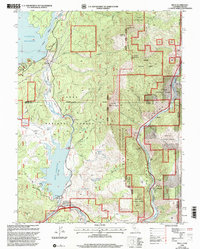
2000 Map of Boca
USGS Topo · Published 2003About this map
The Truckee River carves a critical corridor through this high-country landscape on the California-Nevada border, serving as the primary artery for both water and infrastructure at the turn of the millennium. The settlement of Floriston sits along the river's bend, while the historical significance of the area is preserved at the Boca Townsite Interpretive Trail near the Boca Dam. The map documents a landscape defined by water management, featuring the massive Stampede Reservoir and Boca Reservoir which dominate the western half of the quadrangle. These reservoirs, connected by the Little Truckee River, illustrate the engineered nature of the modern Sierra Nevada watershed. Traces of the region's earlier travel history are visible in the Emigrant Trail, which winds past Russel Creek and the Ranger Station, following a path much older than the surrounding Tahoe National Forest. The eastern edge is defined by the steep Verdi Range, where Granite Peak and Verdi Peak overlook the small riverside clusters of Mystic and Iceland.
Find a feature on this map
46 named features on this map. Tap any name to fly to it.
Don’t see what you’re looking for? This feature index may not catch every label — zoom into the map to look around manually.
Map Details
Editions of this 2000 Boca Map
This is the sole edition of this map. No revisions or reprints were ever made.
Other maps of this area

1890 · Sierraville
USGS Topo · 1:125,000

1891 · Carson
USGS Topo · 1:125,000

1891 · Truckee
USGS Topo · 1:125,000

1891 · Reno
USGS Topo · 1:125,000

1892 · Sierraville
USGS Topo · 1:125,000

1893 · Carson
USGS Topo · 1:125,000

1893 · Truckee
USGS Topo · 1:125,000

1893 · Reno
USGS Topo · 1:125,000

1894 · Sierraville
USGS Topo · 1:125,000

1895 · Truckee
USGS Topo · 1:125,000