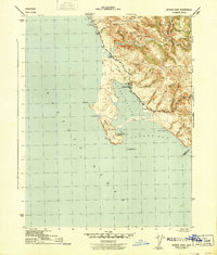
1944 Map of Bodega Head
USGS Topo · Published 1944About this map
Bodega Harbor and the protective spit of Doran Beach dominate this mid-century coastal survey. The terrain transitions from the rocky shoreline at Mussel Pt and Horseshoe Cove to the steep ridges of Mount Roscoe and Irish Hill. In the north, the small settlement of Salmon Creek sits near the mouth of its namesake waterway, while the rural landscape inland is dotted with family-named features like Coleman Hill and the Ocean View Sch. The intricate network of ravines, including Cheney Gulch and Johnson Gulch, illustrates the complex drainage of the Sonoma coast. Local road networks like Valley Ford Road connect these coastal outposts to the interior, reflecting a period of quiet rural development and maritime orientation before significant modern expansion. The map also captures several named offshore hazards, notably Bodega Rock and Arched Rock.
Find a feature on this map
37 named features on this map. Tap any name to fly to it.
Don’t see what you’re looking for? This feature index may not catch every label — zoom into the map to look around manually.
Map Details
Editions of this 1944 Bodega Head Map
3 editions found
Other maps of this area

1916 · Point Reyes
USGS Topo · 1:48,000

1918 · Point Reyes
USGS Topo · 1:62,500

1935 · Sebastopol
USGS Topo · 1:48,000

1942 · Sebastopol
USGS Topo · 1:62,500

1942 · Bodega Head
USGS Topo · 1:24,000

1942 · Arched Rock
USGS Topo · 1:24,000

1943 · Duncans Mills
USGS Topo · 1:24,000

1944 · Bodega Head
USGS Topo · 1:31,680
1944 · Arched Rock
USGS Topo · 1:31,680
1945 · Duncans Mills
USGS Topo · 1:31,680