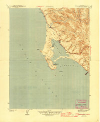
1944 Map of Bodega Head
USGS Topo · Published 1944About this map
The coastal village of Bodega Bay and the sheltering peninsula of Bodega Head anchor this mid-century maritime landscape. Surveyed in 1942, the map shows the delicate balance between the exposed Pacific Ocean and the protected waters of Bodega Harbor, joined by the narrow channel at Campbell Cove. Inland, the terrain rises sharply toward family-named peaks and coastal hills like Mount Roscoe and Irish Hill, while the small settlement of Bodega sits nestled along the road to the east.
Find a feature on this map
32 named features on this map. Tap any name to fly to it.
Don’t see what you’re looking for? This feature index may not catch every label — zoom into the map to look around manually.
Map Details
Editions of this 1944 Bodega Head Map
3 editions found
Other maps of this area

1916 · Point Reyes
USGS Topo · 1:48,000

1918 · Point Reyes
USGS Topo · 1:62,500

1935 · Sebastopol
USGS Topo · 1:48,000

1942 · Sebastopol
USGS Topo · 1:62,500

1942 · Bodega Head
USGS Topo · 1:24,000

1942 · Arched Rock
USGS Topo · 1:24,000

1943 · Duncans Mills
USGS Topo · 1:24,000

1944 · Bodega Head
USGS Topo · 1:31,680
1944 · Arched Rock
USGS Topo · 1:31,680
1945 · Duncans Mills
USGS Topo · 1:31,680