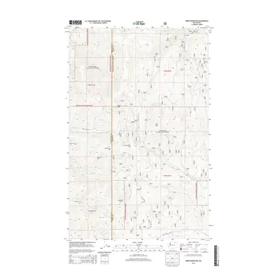
2014 Map of Bodie Mountain
USGS Topo · Published 2014About this map
Okanogan National Forest and Colville National Forest dominate this high-altitude landscape along the border of Okanogan Co and Ferry County. The terrain is defined by a series of prominent peaks, including Bodie Mtn, Hardscrabble Mtn, and Harvard Mtn, which orchestrate a complex drainage system of mountain creeks. Significant water sources such as Bodie Cr, Tonata Cr, and Trout Cr carve through the forested slopes. Human activity is evidenced by a network of forest roads and the seasonal Cow Camp in the northeast corner. The map illustrates a transitional wilderness where the management of two major national forests meets, separated by the county line. Numerous springs, including Slate Spring, Bodie Spring, and Cargo Spring, point to the essential water locations that have long supported cattle grazing and timber interests in this part of Washington's northeastern highlands.
Find a feature on this map
37 named features on this map. Tap any name to fly to it.
Don’t see what you’re looking for? This feature index may not catch every label — zoom into the map to look around manually.
Map Details
Editions of this 2014 Bodie Mountain Map
This is the sole edition of this map. No revisions or reprints were ever made.
Other maps of this area

1904 · Republic
USGS Topo · 1:125,000

1948 · Curlew
USGS Topo · 1:62,500

1948 · Republic
USGS Topo · 1:62,500

1951 · Wauconda
USGS Topo · 1:62,500

1951 · Curlew
USGS Topo · 1:62,500

1951 · Bodie Mountain
USGS Topo · 1:62,500

1951 · Republic
USGS Topo · 1:62,500

1954 · Okanogan
USGS Topo · 1:250,000

1958 · Okanogan
USGS Topo · 1:250,000

1958 · Aeneas
USGS Topo · 1:62,500