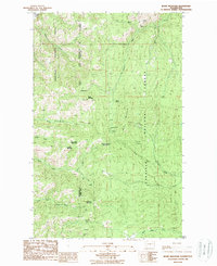
1988 Map of Bodie Mountain
USGS Topo · Published 1988About this map
Bodie Mountain and the surrounding high country of the Kettle River Range define this landscape along the boundary of the Okanogan National Forest and Colville National Forest. The map documents a rugged interior geography where the Okanogan Co Ferry Co line bisects several prominent peaks, including Hardscrabble Mountain, Harvard Mountain, and Manhattan Mountain. Evidence of the region’s mineral history is concentrated south of the peak at Bodie, where numerous operations including Mineshaft Prospects, Open Pits, and several unnamed mines are situated. Water sources such as Bodie Spring and Kelly Spring feed the complex drainage network of Bodie Creek and the various forks of Trout Creek, supporting the seasonal high-altitude activities at places like Cow Camp.
Find a feature on this map
38 named features on this map. Tap any name to fly to it.
Don’t see what you’re looking for? This feature index may not catch every label — zoom into the map to look around manually.
Map Details
Editions of this 1988 Bodie Mountain Map
This is the sole edition of this map. No revisions or reprints were ever made.
Other maps of this area

1904 · Republic
USGS Topo · 1:125,000

1948 · Curlew
USGS Topo · 1:62,500

1948 · Republic
USGS Topo · 1:62,500

1951 · Wauconda
USGS Topo · 1:62,500

1951 · Curlew
USGS Topo · 1:62,500

1951 · Bodie Mountain
USGS Topo · 1:62,500

1951 · Republic
USGS Topo · 1:62,500

1954 · Okanogan
USGS Topo · 1:250,000

1958 · Okanogan
USGS Topo · 1:250,000

1958 · Aeneas
USGS Topo · 1:62,500