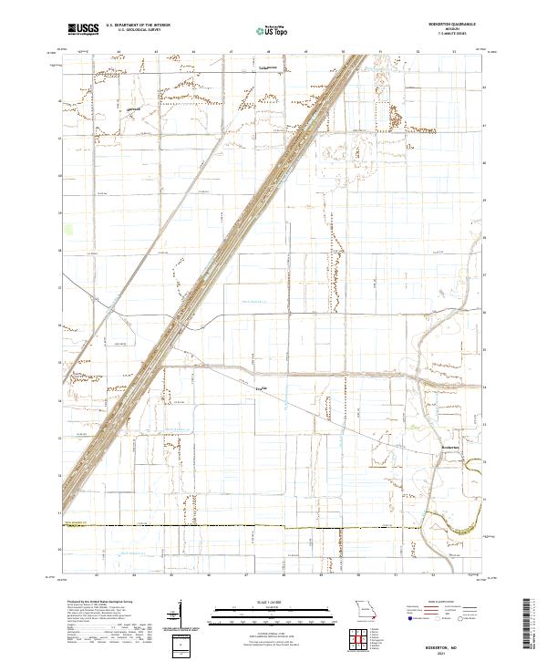
2021 Map of Boekerton
USGS Topo · Published 2021About this map
The alluvial plains of the Missouri Bootheel define this landscape, where a sophisticated network of drainage canals has transformed the terrain for agriculture. Small rural clusters like Boekerton and Tallapoosa anchor a grid of county roads and fields, illustrating the region's long-standing reliance on reclaimed land. The intricate hydrology is visible through numbered waterways such as Ditch Number 57 and Ditch Number 1, which crisscross the territory to manage the flow toward the Little River.
Find a feature on this map
55 named features on this map. Tap any name to fly to it.
Don’t see what you’re looking for? This feature index may not catch every label — zoom into the map to look around manually.
Map Details
Editions of this 2021 Boekerton Map
This is the sole edition of this map. No revisions or reprints were ever made.
Other maps of this area

1939 · Portageville
USGS Topo · 1:62,500

1939 · New Madrid
USGS Topo · 1:62,500

1940 · Malden
USGS Topo · 1:62,500

1940 · Pascola
USGS Topo · 1:62,500

1954 · New Madrid
USGS Topo · 1:62,500

1955 · Pascola
USGS Topo · 1:62,500

1955 · Portageville
USGS Topo · 1:62,500

1956 · Malden
USGS Topo · 1:62,500

1956 · Dyersburg
USGS Topo · 1:250,000
1971 · Catron
USGS Topo · 1:24,000