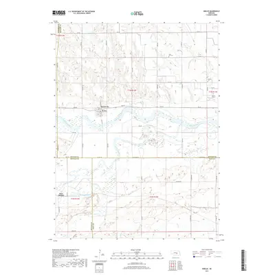
2017 Map of Boelus
USGS Topo · Published 2017About this map
The confluence of the Middle Loup River and South Loup River anchors this central Nebraska landscape, where the village of Boelus (also identified as Howard City) sits on the northern bank. This river system creates a complex network of channels and wetlands that contrast with the organized grid of agricultural section lines. To the south, the small settlement of Saint Michael is positioned near the banks of the South Loup River, illustrating the historical importance of river proximity for early homesteads and rail-adjacent communities.
Find a feature on this map
52 named features on this map. Tap any name to fly to it.
Don’t see what you’re looking for? This feature index may not catch every label — zoom into the map to look around manually.
Map Details
Editions of this 2017 Boelus Map
This is the sole edition of this map. No revisions or reprints were ever made.
Other maps of this area

1895 · Wood River
USGS Topo · 1:62,500

1896 · Wood River
USGS Topo · 1:125,000

1899 · Loup
USGS Topo · 1:125,000

1953 · Dannebrog
USGS Topo · 1:24,000

1953 · Rockville
USGS Topo · 1:24,000

1953 · Boelus
USGS Topo · 1:24,000

1953 · Farwell
USGS Topo · 1:24,000

1953 · Nysted
USGS Topo · 1:24,000

1953 · Ashton
USGS Topo · 1:24,000

1955 · Broken Bow
USGS Topo · 1:250,000