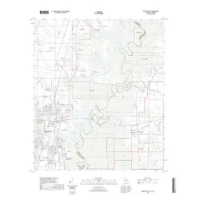
2018 Map of Bogalusa East
USGS Topo · Published 2018About this map
Bogalusa and the surrounding piney woods of Washington Parish are defined by the meandering course of the Pearl River, which serves as the boundary between Louisiana and Mississippi. The city's eastern edge transitions into a dense river bottomland of oxbows and islands, including Hamp Island and Peters Island, where waterways like Pushepatapa Creek and Bogue Lusa Creek converge. The landscape is dotted with several family and community burial grounds, such as Ponemah Cem and Mount Olive Cem, which anchor the local genealogical history of the area.
Find a feature on this map
115 named features on this map. Tap any name to fly to it.
Don’t see what you’re looking for? This feature index may not catch every label — zoom into the map to look around manually.
Map Details
Editions of this 2018 Bogalusa East Map
This is the sole edition of this map. No revisions or reprints were ever made.
Other maps of this area

1942 · Rio
USGS Topo · 1:31,680

1942 · Pools Bluff
USGS Topo · 1:31,680

1949 · Bogalusa East
USGS Topo · 1:31,680

1949 · Angie
USGS Topo · 1:31,680

1949 · Bogalusa West
USGS Topo · 1:31,680

1950 · Crains Creek
USGS Topo · 1:31,680

1953 · Mobile
USGS Topo · 1:250,000

1957 · Mobile
USGS Topo · 1:250,000

1958 · Picayune
USGS Topo · 1:62,500

1959 · Bogalusa
USGS Topo · 1:62,500