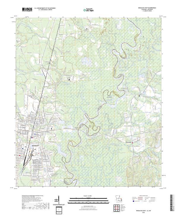
2024 Map of Bogalusa East
USGS Topo · Published 2024About this map
The Pearl River winds through this landscape on the border of Louisiana and Mississippi, creating a complex network of oxbows and islands including Hamp Island and Peters Island. Near the industrial and residential core of Bogalusa, the map reveals a community defined by its proximity to these waters, with Bogue Lusa Creek and Coburn Creek feeding into the main river channel. Local genealogy is well-supported by several burial grounds, from the large Ponemah Cem to the rural Kennedy Cem and Miley Cem. Education and regional services are anchored by the Northshore Technical Community College Sullivan Campus and the George R Carr Memorial Air Field. The map also captures the eastern settlement of Crossroads and a series of distinct water bodies like Old Jail Lake and Horseshoe Lake, illustrating the transition from the city's street grid to the swampy lowlands.
Find a feature on this map
115 named features on this map. Tap any name to fly to it.
Don’t see what you’re looking for? This feature index may not catch every label — zoom into the map to look around manually.
Map Details
Editions of this 2024 Bogalusa East Map
This is the sole edition of this map. No revisions or reprints were ever made.
Other maps of this area

1942 · Rio
USGS Topo · 1:31,680

1942 · Pools Bluff
USGS Topo · 1:31,680

1949 · Bogalusa East
USGS Topo · 1:31,680

1949 · Angie
USGS Topo · 1:31,680

1949 · Bogalusa West
USGS Topo · 1:31,680

1950 · Crains Creek
USGS Topo · 1:31,680

1953 · Mobile
USGS Topo · 1:250,000

1957 · Mobile
USGS Topo · 1:250,000

1958 · Picayune
USGS Topo · 1:62,500

1959 · Bogalusa
USGS Topo · 1:62,500