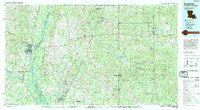
1994 Map of Bogalusa
USGS Topo · Published 1994About this map
Bogalusa and the surrounding piney woods of the Louisiana-Mississippi borderlands appear here during the mid-1990s, defined by a complex network of river systems and timberlands. The Pearl River and Bogue Chitto cut through the western reaches, where the Bogue Chitto National Wildlife Refuge preserves the bottomland hardwood habitat. To the east, the landscape transitions into the extensive De Soto National Forest, an area historically tied to the yellow pine industry and naval stores production.
Find a feature on this map
110 named features on this map. Tap any name to fly to it.
Don’t see what you’re looking for? This feature index may not catch every label — zoom into the map to look around manually.
Map Details
Editions of this 1994 Bogalusa Map
2 editions found
Other maps of this area

1914 · Nicholson
USGS Topo · 1:62,500

1921 · Nicholson
USGS Topo · 1:62,500

1935 · Slidell
USGS Topo · 1:62,500

1935 · Covington
USGS Topo · 1:62,500

1939 · Slidell
USGS Topo · 1:62,500

1939 · Zona
USGS Topo · 1:31,680

1939 · Covington
USGS Topo · 1:62,500

1941 · Honey Island
USGS Topo · 1:31,680

1942 · Waldheim
USGS Topo · 1:31,680

1942 · Thigpen
USGS Topo · 1:31,680