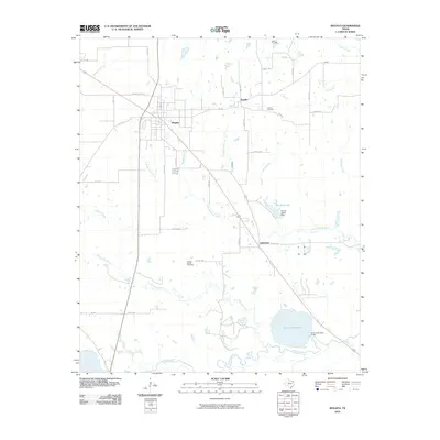
2010 Map of Bogata
USGS Topo · Published 2010About this map
The town of Bogata serves as the primary hub of this Red River County landscape, situated at the intersection of US Hwy 271D Bus and several county roads. The settlement pattern is defined by small communities and rural intersections, including Rosalie to the northeast and Johntown to the southeast. Family history and local heritage are anchored by sites such as Dodd Cemetery, Hinson Cemetery, and Cooper-Woods Cemetery, which are scattered among the agricultural plots.
Find a feature on this map
44 named features on this map. Tap any name to fly to it.
Don’t see what you’re looking for? This feature index may not catch every label — zoom into the map to look around manually.
Map Details
Editions of this 2010 Bogata Map
This is the sole edition of this map. No revisions or reprints were ever made.
Other maps of this area

1953 · Texarkana
USGS Topo · 1:250,000

1956 · Texarkana
USGS Topo · 1:250,000

1963 · Mitchell Creek
USGS Topo · 1:24,000

1963 · Cunningham
USGS Topo · 1:24,000

1964 · Deport
USGS Topo · 1:24,000

1964 · Cuthand
USGS Topo · 1:24,000

1964 · Talco
USGS Topo · 1:24,000

1964 · Hagansport
USGS Topo · 1:24,000

1964 · Bogata
USGS Topo · 1:24,000
1964 · Line Branch
USGS Topo · 1:24,000