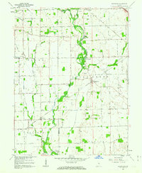
1962 Map of Boggstown
USGS Topo · Published 1963About this map
Sugar Creek defines the landscape of this central Indiana region, its winding path punctuated by recreation and industry during the early 1960s. Historical milling is evidenced at The Red Mills, while seasonal activity is reflected in riverside spots like Walnut Grove Camp and Camp Joy. The settlement patterns follow both water and rail, with Boggstown and Needham serving as local hubs along the New York Central railroad.
Find a feature on this map
44 named features on this map. Tap any name to fly to it.
Don’t see what you’re looking for? This feature index may not catch every label — zoom into the map to look around manually.
Map Details
Editions of this 1962 Boggstown Map
4 editions found
Other maps of this area

1942 · Franklin
USGS Topo · 1:125,000

1942 · Columbus
USGS Topo · 1:125,000

1947 · Franklin
USGS Topo · 1:62,500

1948 · Franklin
USGS Topo · 1:24,000

1948 · Beech Grove
USGS Topo · 1:24,000

1948 · Lewis Creek
USGS Topo · 1:24,000

1948 · Marietta
USGS Topo · 1:24,000

1950 · Franklin
USGS Topo · 1:62,500

1950 · Edinburg
USGS Topo · 1:62,500

1952 · Fountaintown
USGS Topo · 1:24,000