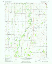
1962 Map of Boggstown
USGS Topo · Published 1978About this map
London sits at the northern edge of this landscape, a region defined by a intricate network of drainage and small waterways in Shelby County. The terrain is shaped by the winding course of Sugar Creek and its many tributaries, including Little Sugar Creek and Snail Creek. The reliance on local hydrology is evident in the man-made improvements to the land, such as Cutsinger Ditch and Gibson Ditch, which suggest a history of agricultural development and water management. To the east, the landscape is bounded by Brandywine Creek, while northern reaches are touched by Buck Creek and Leatherwood Run. This 1962 revision, based on earlier surveys by the Indiana Department of Conservation, provides a clear view of the rural infrastructure and natural drainage patterns that supported these central Indiana communities before the expansion of modern suburban footprints.
Find a feature on this map
11 named features on this map. Tap any name to fly to it.
Don’t see what you’re looking for? This feature index may not catch every label — zoom into the map to look around manually.
Map Details
Editions of this 1962 Boggstown Map
4 editions found
Other maps of this area

1942 · Franklin
USGS Topo · 1:125,000

1942 · Columbus
USGS Topo · 1:125,000

1947 · Franklin
USGS Topo · 1:62,500

1948 · Franklin
USGS Topo · 1:24,000

1948 · Beech Grove
USGS Topo · 1:24,000

1948 · Lewis Creek
USGS Topo · 1:24,000

1948 · Marietta
USGS Topo · 1:24,000

1950 · Franklin
USGS Topo · 1:62,500

1950 · Edinburg
USGS Topo · 1:62,500

1952 · Fountaintown
USGS Topo · 1:24,000