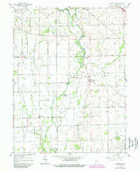
1962 Map of Boggstown
USGS Topo · Published 1988About this map
Sugar Creek winds through the heart of this landscape, anchoring a series of riverside landmarks including The Red Mills and recreational sites like Broad Ripple Camp and Walnut Grove Camp. The map documents a transition in rural Indiana, where established agricultural settlements like Boggstown and Needham are situated alongside numerous family burial grounds, such as Hough Cem, Gallagher Cem, and Wiles Cem. This survey reflects the mid-century infrastructure of Johnson and Shelby Counties, showing the intricate web of drainage ditches like Gibson Ditch that sustain the local farmland. Genealogists will find particular value in the localized labels for early rural institutions, including Needham Ch and the remote Sandhill Cem located in the southeastern quadrant of the sheet.
Find a feature on this map
43 named features on this map. Tap any name to fly to it.
Don’t see what you’re looking for? This feature index may not catch every label — zoom into the map to look around manually.
Map Details
Editions of this 1962 Boggstown Map
4 editions found
Other maps of this area

1942 · Franklin
USGS Topo · 1:125,000

1942 · Columbus
USGS Topo · 1:125,000

1947 · Franklin
USGS Topo · 1:62,500

1948 · Franklin
USGS Topo · 1:24,000

1948 · Beech Grove
USGS Topo · 1:24,000

1948 · Lewis Creek
USGS Topo · 1:24,000

1948 · Marietta
USGS Topo · 1:24,000

1950 · Franklin
USGS Topo · 1:62,500

1950 · Edinburg
USGS Topo · 1:62,500

1952 · Fountaintown
USGS Topo · 1:24,000