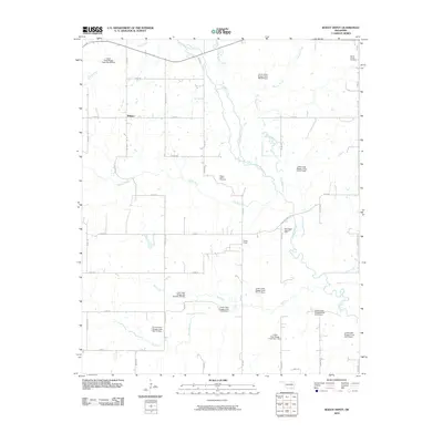
2010 Map of Boggy Depot
USGS Topo · Published 2010About this map
Boggy Depot serves as the focal point of this landscape, a site of deep historical significance in Oklahoma's Choctaw Nation territory. The 2010 map highlights a region defined by an intricate network of waterways and modern conservation efforts, including numerous flood control structures like Lower Clear Boggy Creek Site 7 Dam. The presence of the East Boggy Depot Oil Field points to the continued industrial importance of the area, while the Overland Trl and N Boggy Depot Rd trace old routes through the rural terrain. Genealogists will find interest in the Boggy Depot Cemetery and Wards Chapel Cemetery, which anchor the local history of the Wilson community. From the cascading Rock Creek Falls to the meandering Clear Boggy Creek, the map details a landscape where natural hydrology and human resource management intersect.
Find a feature on this map
50 named features on this map. Tap any name to fly to it.
Don’t see what you’re looking for? This feature index may not catch every label — zoom into the map to look around manually.
Map Details
Editions of this 2010 Boggy Depot Map
This is the sole edition of this map. No revisions or reprints were ever made.
Other maps of this area

1899 · Atoka
USGS Topo · 1:125,000

1900 · Atoka
USGS Topo · 1:125,000

1957 · Lehigh
USGS Topo · 1:24,000

1957 · Ardmore
USGS Topo · 1:250,000

1963 · Ardmore
USGS Topo · 1:250,000
1968 · Wapanucka South
USGS Topo · 1:24,000

1968 · Caddo NW
USGS Topo · 1:24,000
1969 · Boggy Depot
USGS Topo · 1:24,000

1969 · Caddo North
USGS Topo · 1:24,000
1969 · Tushka
USGS Topo · 1:24,000