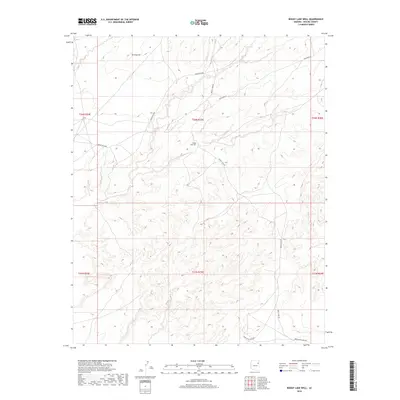
2018 Map of Boggy Lake Well
USGS Topo · Published 2018About this map
Boggy Lake Well sits at the center of this 2018 topographic survey in the high desert of Apache County, Arizona. The terrain is defined by complex contour elevations and prominent landmarks such as Turning Hill, which overlooks a network of remote corridors including Indian Rte 9606 and Indian Rte 9406. This map illustrates the vital role of water access in the arid Southwest, with the eponymous well serving as a primary named feature for the surrounding landscape. Transport and access are mapped through the routes that traverse the mesa, most notably Boggy Lake Rd and the long stretch of Dead Wood Mesa Rd at the southern boundary. These roads and tracks follow the natural contours of the land, revealing the sparse but essential infrastructure required for managing this vast region of the Fort Defiance Agency.
Find a feature on this map
14 named features on this map. Tap any name to fly to it.
Don’t see what you’re looking for? This feature index may not catch every label — zoom into the map to look around manually.
Map Details
Editions of this 2018 Boggy Lake Well Map
This is the sole edition of this map. No revisions or reprints were ever made.
Other maps of this area

1886 · Fort Defiance
USGS Topo · 1:250,000

1892 · Fort Defiance
USGS Topo · 1:250,000

1954 · Gallup
USGS Topo · 1:250,000

1958 · Gallup
USGS Topo · 1:250,000

1959 · Gallup
USGS Topo · 1:250,000

1962 · Gallup
USGS Topo · 1:250,000

1967 · Gallup
USGS Topo · 1:250,000
1972 · Tanner Springs
USGS Topo · 1:24,000
1972 · Greasewood
USGS Topo · 1:24,000
1972 · Boggy Lake Well
USGS Topo · 1:24,000