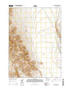
2014 Map of Boghole Spring
USGS Topo · Published 2014About this map
The Oregon Canyon Mountains dominate this high-desert landscape in Malheur County, providing a series of vital water sources in a primarily arid environment. Several distinctive peaks and plateaus, such as Mendi Suri and the prominent Flattop, define the local topography. This region is marked by its numerous isolated water points, ranging from named springs like Boghole Spring and Bryson Spring to more specialized sites like Muers Waterhole and Hot Spring. The drainage network, including Oregon Canyon Cr and Rock Cr, flows through the broken terrain towards The Slough. Transportation in this part of the Oregon high desert is limited to primitive routes like Disaster Peak Rd and Mcdermitt Rd, which follow the natural contours of the foothills and canyons, connecting the various springs and livestock watering points that support the area's grazing activities.
Find a feature on this map
24 named features on this map. Tap any name to fly to it.
Don’t see what you’re looking for? This feature index may not catch every label — zoom into the map to look around manually.
Map Details
Editions of this 2014 Boghole Spring Map
This is the sole edition of this map. No revisions or reprints were ever made.
Other maps of this area

1882 · Paradise
USGS Topo · 1:250,000

1893 · Paradise
USGS Topo · 1:250,000

1955 · McDermitt
USGS Topo · 1:250,000

1955 · Jordan Valley
USGS Topo · 1:250,000

1957 · Jordan Valley
USGS Topo · 1:250,000

1958 · Jordan Valley
USGS Topo · 1:250,000

1959 · McDermitt
USGS Topo · 1:250,000

1959 · McDermitt
USGS Topo · 1:62,500

1959 · Jordan Meadow
USGS Topo · 1:62,500
1982 · Oregon Canyon Ranch
USGS Topo · 1:24,000