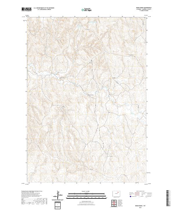
2021 Map of Bogie Draw
USGS Topo · Published 2021About this map
Bogie Draw winds through the high plains of Campbell County, carving a distinct drainage pattern across this ranching landscape. This modern survey illustrates a network of essential water management features, including Bogie Reservoir and Dead Horse Reservoir Number 2, which are critical for livestock and wildlife in this semi-arid region. The map reveals the intricate topography of the Powder River Basin, where named intermittent features like Kaufman Draw and Bridge Draw define the local relief. The presence of Beaver Cr and local routes such as Napier Rd and Iberlin Rd show the infrastructure supporting modern land use. The Public Land Survey System grid, including township markers for t48n r76w and t47n r75w, remains the fundamental framework for property and navigation in this open country.
Find a feature on this map
12 named features on this map. Tap any name to fly to it.
Don’t see what you’re looking for? This feature index may not catch every label — zoom into the map to look around manually.
Map Details
Editions of this 2021 Bogie Draw Map
This is the sole edition of this map. No revisions or reprints were ever made.
Other maps of this area

1953 · Fats Draw
USGS Topo · 1:24,000

1953 · The Nipple
USGS Topo · 1:24,000

1954 · Gillette
USGS Topo · 1:250,000

1955 · Newcastle
USGS Topo · 1:250,000

1955 · Sheridan
USGS Topo · 1:250,000

1955 · Arminto
USGS Topo · 1:250,000

1955 · Gillette
USGS Topo · 1:250,000

1958 · Gillette
USGS Topo · 1:250,000

1958 · Sheridan
USGS Topo · 1:250,000

1958 · Arminto
USGS Topo · 1:250,000