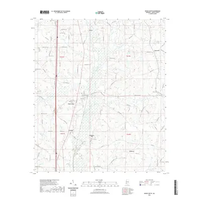
2020 Map of Bogue Chitto
USGS Topo · Published 2020About this map
Bogue Chitto serves as a central hub for this portion of Lincoln County, where the local road network and residential plots cluster near the Missionary Cem. The landscape is defined by the winding course of Bogue Chitto and its numerous tributaries, including Sandust Br, Gills Cr, and Moaks Cr. Smaller named settlements like Norfield, Wilkinson, and Thayer are scattered across the terrain, connected by a dense web of local tracks and lanes such as Knollwood Trl Se and Hog Chain Dr Se. For genealogists, the map is particularly useful for locating several family-named burial grounds, including Stewarts Cem, Rawls Cem, and Price Cem, which are tucked away near the higher ground of Blueberry Hill. The topography illustrates a typical Mississippi piney woods environment, segmented by creek bottoms and small agricultural clearings.
Find a feature on this map
92 named features on this map. Tap any name to fly to it.
Don’t see what you’re looking for? This feature index may not catch every label — zoom into the map to look around manually.
Map Details
Editions of this 2020 Bogue Chitto Map
This is the sole edition of this map. No revisions or reprints were ever made.
Other maps of this area

1953 · Natchez
USGS Topo · 1:250,000

1956 · Natchez
USGS Topo · 1:250,000

1959 · Natchez
USGS Topo · 1:250,000

1972 · West Lincoln
USGS Topo · 1:24,000

1972 · Fair Oak Springs
USGS Topo · 1:24,000

1972 · Auburn
USGS Topo · 1:24,000

1972 · Ruth
USGS Topo · 1:24,000

1972 · Pricedale
USGS Topo · 1:24,000

1972 · Bogue Chitto
USGS Topo · 1:24,000

1972 · Brookhaven
USGS Topo · 1:24,000