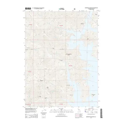
2015 Map of Bohemotash Mountain
USGS Topo · Published 2015About this map
Bohemotash Mountain rises as a prominent landmark in this region of northern California, where the rugged drainages of the Shasta National Forest meet the convoluted shoreline of Shasta Lake. The map details a complex network of canyons and gulches, such as Dark Canyon and Sawmill Gulch, which feed into the reservoir's western arms. This 2015 survey reflects a landscape shaped by water management and forest service operations, tracing several creeks including Sugarloaf Cr and Backbone Cr as they descend from high peaks like Elmore Mtn and Mammoth Butte. For the researcher, the map preserves the names of distinct topographical features such as Slaughterhouse Island and Backbone Ridge, as well as localized water sources like Shoemaker Spring. The distribution of named gulches and ridges suggests a history of timber and mining activity typical of the Klamath Mountains transition into the Sacramento Valley watershed.
Find a feature on this map
41 named features on this map. Tap any name to fly to it.
Don’t see what you’re looking for? This feature index may not catch every label — zoom into the map to look around manually.
Map Details
Editions of this 2015 Bohemotash Mountain Map
This is the sole edition of this map. No revisions or reprints were ever made.
Other maps of this area

1890 · Red Bluff
USGS Topo · 1:250,000

1894 · Red Bluff
USGS Topo · 1:250,000

1901 · Redding
USGS Topo · 1:125,000

1913 · Weaverville
USGS Topo · 1:125,000

1944 · Redding
USGS Topo · 1:62,500

1944 · French Gulch
USGS Topo · 1:62,500

1946 · Lamoine
USGS Topo · 1:62,500

1946 · Redding
USGS Topo · 1:62,500

1948 · French Gulch
USGS Topo · 1:62,500

1950 · Schell Mtn
USGS Topo · 1:62,500