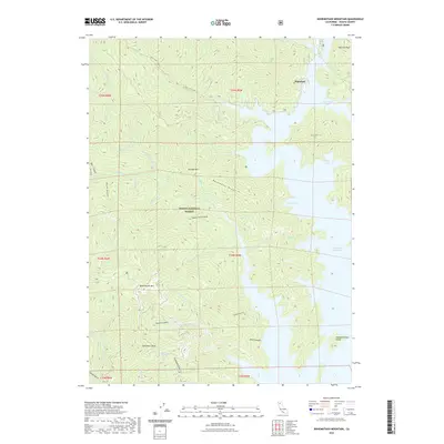
2022 Map of Bohemotash Mountain
USGS Topo · Published 2022About this map
Shasta Lake dominates the eastern half of this terrain, where its sprawling waters reach into the Sacramento River Arm and Salt Creek Inlet. This 2022 survey captures the complex shoreline and high-relief interior of the Shasta National Forest, a landscape defined by deep drainages like Dark Canyon and Shoemaker Gulch. In the high country to the west, Bohemotash Mtn and Mammoth Butte overlook the watersheds of N Fork Little Backbone Cr and Mary Fork. The map documents a rugged topography where narrow ridges like Backbone Ridge separate numerous seasonal and perennial creeks. Traces of human presence are sparse, indicated by features such as Shoemaker Spring and the Sugar Loaf Creek Trl, while landmarks like Slaughterhouse Island remain above the waterline of the reservoir.
Find a feature on this map
51 named features on this map. Tap any name to fly to it.
Don’t see what you’re looking for? This feature index may not catch every label — zoom into the map to look around manually.
Map Details
Editions of this 2022 Bohemotash Mountain Map
This is the sole edition of this map. No revisions or reprints were ever made.
Other maps of this area

1890 · Red Bluff
USGS Topo · 1:250,000

1894 · Red Bluff
USGS Topo · 1:250,000

1901 · Redding
USGS Topo · 1:125,000

1913 · Weaverville
USGS Topo · 1:125,000

1944 · Redding
USGS Topo · 1:62,500

1944 · French Gulch
USGS Topo · 1:62,500

1946 · Lamoine
USGS Topo · 1:62,500

1946 · Redding
USGS Topo · 1:62,500

1948 · French Gulch
USGS Topo · 1:62,500

1950 · Schell Mtn
USGS Topo · 1:62,500