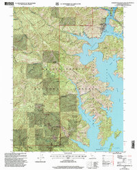
1998 Map of Bohemotash Mountain
USGS Topo · Published 2003About this map
Shasta Lake dominates this landscape, its intricate shoreline carved into numerous arms and inlets that define the recreational and industrial character of the region. The map captures the rugged interior of the Shasta-Trinity National Forest, where steep ridges like Backbone Ridge descend into the water. Significant mining history is visible near the southern ridges, particularly at the Golinsky Mine and several unnamed Mines and Prospects scattered across the terrain. These mineral sites, tucked away from the more developed shoreline, suggest a legacy of extraction that predates the modern recreational focus of the lake.
Find a feature on this map
40 named features on this map. Tap any name to fly to it.
Don’t see what you’re looking for? This feature index may not catch every label — zoom into the map to look around manually.
Map Details
Editions of this 1998 Bohemotash Mountain Map
This is the sole edition of this map. No revisions or reprints were ever made.
Other maps of this area

1890 · Red Bluff
USGS Topo · 1:250,000

1894 · Red Bluff
USGS Topo · 1:250,000

1901 · Redding
USGS Topo · 1:125,000

1913 · Weaverville
USGS Topo · 1:125,000

1944 · Redding
USGS Topo · 1:62,500

1944 · French Gulch
USGS Topo · 1:62,500

1946 · Lamoine
USGS Topo · 1:62,500

1946 · Redding
USGS Topo · 1:62,500

1948 · French Gulch
USGS Topo · 1:62,500

1950 · Schell Mtn
USGS Topo · 1:62,500