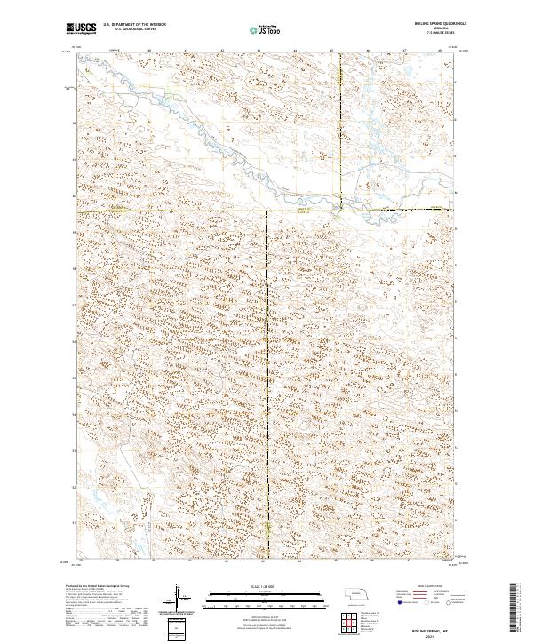
2021 Map of Boiling Spring
USGS Topo · Published 2021About this map
The Calamus River meanders across this corner of the Nebraska Sandhills, defining a landscape of shifting topography where the borders of Brown, Blaine, Loup, and Rock counties converge. The river's path is tracked by the Calamus River Trl, while the eponymous Boiling Spring serves as a distinctive hydrological landmark on the southern bank. This 2021 survey illustrates a remote ranching region where human presence is marked primarily by section lines and gravel paths like 846 Rd. The terrain is characterized by intricate contouring that reveals the complex dune structures typical of this prairie environment, with few permanent structures beyond the occasional rural road such as Co Rd 2 24.
Find a feature on this map
16 named features on this map. Tap any name to fly to it.
Don’t see what you’re looking for? This feature index may not catch every label — zoom into the map to look around manually.
Map Details
Editions of this 2021 Boiling Spring Map
This is the sole edition of this map. No revisions or reprints were ever made.
Other maps of this area

1952 · Brewster
USGS Topo · 1:24,000

1952 · Almeria NE
USGS Topo · 1:24,000

1952 · Almeria NW
USGS Topo · 1:24,000

1955 · Broken Bow
USGS Topo · 1:250,000

1955 · O'Neill
USGS Topo · 1:250,000

1956 · Broken Bow
USGS Topo · 1:250,000

1959 · O'Neill
USGS Topo · 1:250,000

1969 · O'Neill
USGS Topo · 1:250,000

1981 · Boiling Spring
USGS Topo · 1:24,000
1981 · Shovel Dot Ranch
USGS Topo · 1:24,000