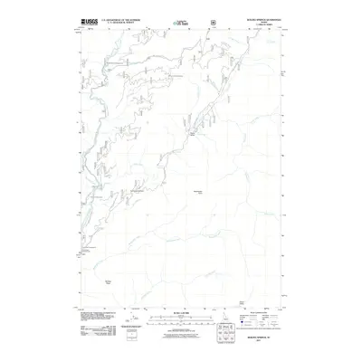
2011 Map of Boiling Springs
USGS Topo · Published 2011About this map
Boiling Springs and the surrounding wilderness of Valley County are defined by a network of National Forest development roads that navigate the complex drainage systems of the Middle Fork Payette River. In 2011, this area served as a remote recreation and work hub, evidenced by the Sixmile Project Camp and several seasonal sites like Trail Creek Campground and Silver Creek Campground. The landscape transitions from the high peaks of Bulldog Ridge down to the thermal activity at Silver Creek Plunge in Peace Valley.
Find a feature on this map
32 named features on this map. Tap any name to fly to it.
Don’t see what you’re looking for? This feature index may not catch every label — zoom into the map to look around manually.
Map Details
Editions of this 2011 Boiling Springs Map
This is the sole edition of this map. No revisions or reprints were ever made.
Other maps of this area

1909 · Garden Valley
USGS Topo · 1:125,000

1953 · Boiling Springs
USGS Topo · 1:62,500

1953 · Deadwood Reservoir
USGS Topo · 1:62,500

1957 · Challis
USGS Topo · 1:250,000

1959 · Garden Valley
USGS Topo · 1:62,500

1960 · Challis
USGS Topo · 1:250,000

1963 · Challis
USGS Topo · 1:250,000

1972 · Scott Creek
USGS Topo · 1:24,000

1982 · Deadwood River
USGS Topo · 1:100,000
1988 · Wild Buck Peak
USGS Topo · 1:24,000