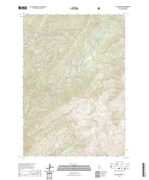
2024 Map of Boiling Springs
USGS Topo · Published 2024About this map
Boiling Springs and the nearby Boiling Springs GS mark a hub of recreational and administrative activity within the Boise National Forest. The landscape is defined by the steep drainages of the Middle Fork Payette River and its numerous tributaries, including Silver Creek, where the Silver Creek Plunge serves as a notable landmark. This modern survey illustrates a network of forest service spurs and specialized trails like the Devil's Slide Tri and Lightning Ridge Tri that navigate the high-elevation terrain of the North Fork Range. Evidence of fire management and backcountry oversight is seen at the Silver Creek Lookout, while more remote locales like Onion Valley and Rattlesnake Point suggest the topographic complexity of this protected wilderness area.
Find a feature on this map
59 named features on this map. Tap any name to fly to it.
Don’t see what you’re looking for? This feature index may not catch every label — zoom into the map to look around manually.
Map Details
Editions of this 2024 Boiling Springs Map
This is the sole edition of this map. No revisions or reprints were ever made.
Other maps of this area

1909 · Garden Valley
USGS Topo · 1:125,000

1953 · Boiling Springs
USGS Topo · 1:62,500

1953 · Deadwood Reservoir
USGS Topo · 1:62,500

1957 · Challis
USGS Topo · 1:250,000

1959 · Garden Valley
USGS Topo · 1:62,500

1960 · Challis
USGS Topo · 1:250,000

1963 · Challis
USGS Topo · 1:250,000

1972 · Scott Creek
USGS Topo · 1:24,000

1982 · Deadwood River
USGS Topo · 1:100,000
1988 · Wild Buck Peak
USGS Topo · 1:24,000