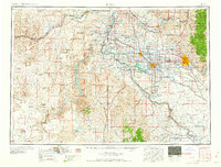
1958 Map of Boise
USGS Topo · Published 1958About this map
The Snake River and its major tributaries, the Boise River and Payette River, anchor the agricultural and industrial landscape of southwestern Idaho and eastern Oregon. In the late 1950s, the growing urban center of Boise and the neighboring community of Garden City sit at the foot of the Boise National Forest, with peaks like Shafer Butte and Lucky Peak rising to the east. The dominance of the Union Pacific railroad lines and major highways such as U.S. 30 illustrates the region's role as a vital transportation corridor connecting the Treasure Valley settlements of Nampa, Caldwell, and Ontario.
Find a feature on this map
193 named features on this map. Tap any name to fly to it.
Don’t see what you’re looking for? This feature index may not catch every label — zoom into the map to look around manually.
Map Details
Editions of this 1958 Boise Map
2 editions found

Other maps of this area

1892 · Mountain Home
USGS Topo · 1:125,000

1892 · Boise
USGS Topo · 1:125,000

1892 · Bisuka
USGS Topo · 1:125,000

1892 · Silver City
USGS Topo · 1:125,000

1893 · Mountain Home
USGS Topo · 1:125,000

1894 · Bisuka
USGS Topo · 1:125,000

1894 · Silver City
USGS Topo · 1:125,000

1894 · Squaw Creek
USGS Topo · 1:125,000

1894 · Idaho Basin
USGS Topo · 1:125,000

1897 · Boise
USGS Topo · 1:125,000