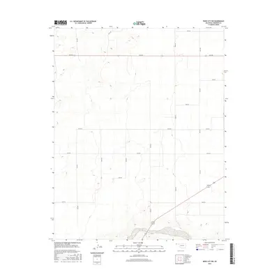
2016 Map of Boise City NW
USGS Topo · Published 2016About this map
Beaver River winds through the southern reaches of this High Plains landscape, its riparian corridor providing a stark contrast to the surrounding grid of section roads and high tableland. This area of Cimarron County is defined by a rigorous network of rural routes, including primary east-west corridors like E0190 Rd and north-south arteries such as N0160 Rd and N0170 Rd. The landscape reflects a deeply ingrained agricultural pattern, where the geometry of the land survey dictates the movement of both people and resources.
Find a feature on this map
17 named features on this map. Tap any name to fly to it.
Don’t see what you’re looking for? This feature index may not catch every label — zoom into the map to look around manually.
Map Details
Editions of this 2016 Boise City NW Map
This is the sole edition of this map. No revisions or reprints were ever made.
Other maps of this area

1954 · Dalhart
USGS Topo · 1:250,000

1958 · Dalhart
USGS Topo · 1:250,000

1962 · Dalhart
USGS Topo · 1:250,000

1969 · Boise City
USGS Topo · 1:24,000

1969 · Boise City NW
USGS Topo · 1:24,000

1969 · Boise City SW
USGS Topo · 1:24,000

1969 · Felt
USGS Topo · 1:24,000

1969 · Flagg Springs
USGS Topo · 1:24,000

1969 · Boise City SE
USGS Topo · 1:24,000

1969 · Felt NE
USGS Topo · 1:24,000