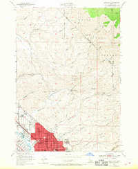
1954 Map of Boise North
USGS Topo · Published 1968About this map
Boise and the northern foothills of the Boise National Forest appear during a period of mid-century urban expansion. The map captures the city's northward reach into the gulches, with the developed residential grid of Garden City and the historic North End marked by landmarks like St Marys Sch and Lowell Sch. Institutional history is well-represented through the presence of the Soldiers Home and the Childrens Home, while the urban-rural interface is defined by sites like the Owyhee Motorcycle Club and Thompson Ranch.
Find a feature on this map
59 named features on this map. Tap any name to fly to it.
Don’t see what you’re looking for? This feature index may not catch every label — zoom into the map to look around manually.
Map Details
Editions of this 1954 Boise North Map
2 editions found
Other maps of this area

1892 · Boise
USGS Topo · 1:125,000

1897 · Boise
USGS Topo · 1:125,000

1949 · Robie Creek
USGS Topo · 1:24,000

1953 · Eagle
USGS Topo · 1:24,000

1953 · Cloverdale
USGS Topo · 1:24,000

1953 · Montour
USGS Topo · 1:62,500

1954 · Boise South
USGS Topo · 1:24,000

1954 · Boise North
USGS Topo · 1:24,000

1954 · Boise
USGS Topo · 1:62,500

1955 · Boise
USGS Topo · 1:250,000