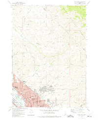
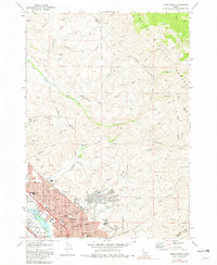
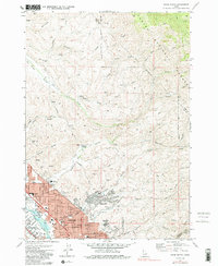
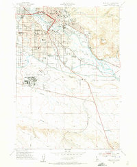
1972 Map of Boise North
USGS Topo · Published 1975About this map
Boise and Garden City sit at the southern edge of this topographic study, where residential neighborhoods meet the steep foothills of the Boise National Forest. The transition from urban center to wilderness is marked by early suburban developments like the Highlands and Boise Hills Village, contrasted with the rugged northern landscape of Bogus Basin and Crane Creek. Genealogists and local historians can trace the mid-century footprint of the city through its numerous educational and religious landmarks, including Lowell Sch, St Marys Sch, and the Bible College. The northern half of the map is dominated by a network of drainage systems like Stewart Gulch and Hulls Gulch, featuring several Borrow Pits and an Old Military Reservation that hint at the varied land use on the city’s periphery during the early 1970s.
Find a feature on this map
72 named features on this map. Tap any name to fly to it.
Don’t see what you’re looking for? This feature index may not catch every label — zoom into the map to look around manually.
Map Details
Editions of this 1972 Boise North Map
3 editions found
Other maps of this area

1892 · Boise
USGS Topo · 1:125,000

1897 · Boise
USGS Topo · 1:125,000
1949 · Robie Creek
USGS Topo · 1:24,000

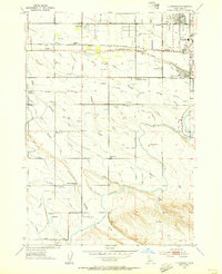
1953 · Eagle
USGS Topo · 1:24,000
1953 · Cloverdale
USGS Topo · 1:24,000

1953 · Montour
USGS Topo · 1:62,500
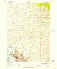
1954 · Boise South
USGS Topo · 1:24,000
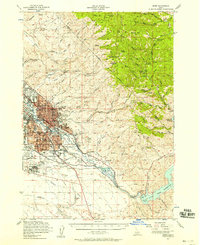
1954 · Boise North
USGS Topo · 1:24,000
1954 · Boise
USGS Topo · 1:62,500

1955 · Boise
USGS Topo · 1:250,000