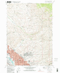
1972 Map of Boise North
USGS Topo · Published 1991About this map
The northern reaches of Boise and Garden City are captured here just as suburban growth began pressing into the foothills. The city grid terminates at the base of the uplift, where the Boise National Forest boundary meets residential developments like Highlands and Boise Hills Village. This transition zone is defined by a series of steep drainages, including Hulls Gulch and Stewart Gulch, which contrast with the level plains along the Boise River.
Find a feature on this map
63 named features on this map. Tap any name to fly to it.
Don’t see what you’re looking for? This feature index may not catch every label — zoom into the map to look around manually.
Map Details
Editions of this 1972 Boise North Map
3 editions found
Other maps of this area

1892 · Boise
USGS Topo · 1:125,000

1897 · Boise
USGS Topo · 1:125,000

1949 · Robie Creek
USGS Topo · 1:24,000

1953 · Eagle
USGS Topo · 1:24,000

1953 · Cloverdale
USGS Topo · 1:24,000

1953 · Montour
USGS Topo · 1:62,500

1954 · Boise South
USGS Topo · 1:24,000

1954 · Boise North
USGS Topo · 1:24,000

1954 · Boise
USGS Topo · 1:62,500

1955 · Boise
USGS Topo · 1:250,000