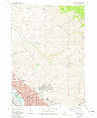
1972 Map of Boise North
USGS Topo · Published 1982About this map
The Boise River flows through the southwestern corner of this survey, defining the boundary between Garden City and the expanding urban core of Boise. By the early 1970s, the foothills north of the State Capitol show significant residential development in the Highlands neighborhood, including the Highlands Sch and a local Golf Course. Beyond the city limits, the terrain transitions sharply into the steep drainages of the Boise National Forest, where a network of trails and unimproved roads like Bogus Basin Road and Cartwright Road navigate numerous deep ravines including Hulls Gulch and Stewart Gulch. Local education and community life are anchored by institutions such as St Marys Sch, Bible College, and North Jr High Sch. The map also reveals the industrial activities of the era through several Borrow Pits and Prospects scattered across the northern ridges.
Find a feature on this map
58 named features on this map. Tap any name to fly to it.
Don’t see what you’re looking for? This feature index may not catch every label — zoom into the map to look around manually.
Map Details
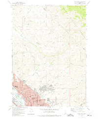
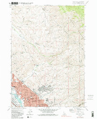
Editions of this 1972 Boise North Map
3 editions found
Other maps of this area

1892 · Boise
USGS Topo · 1:125,000

1897 · Boise
USGS Topo · 1:125,000

1949 · Robie Creek
USGS Topo · 1:24,000

1953 · Eagle
USGS Topo · 1:24,000

1953 · Cloverdale
USGS Topo · 1:24,000

1953 · Montour
USGS Topo · 1:62,500

1954 · Boise South
USGS Topo · 1:24,000

1954 · Boise North
USGS Topo · 1:24,000

1954 · Boise
USGS Topo · 1:62,500

1955 · Boise
USGS Topo · 1:250,000