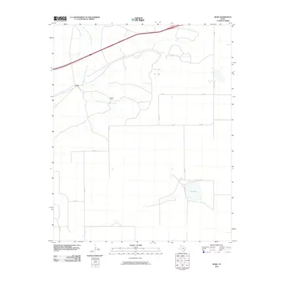
2010 Map of Boise
USGS Topo · Published 2010About this map
The settlement of Boise in the Texas Panhandle is defined by a landscape of sprawling ranchland and ephemeral waterways. In this high plains region of Oldham County, human presence is primarily marked by rural road networks like Fm 2858 and Co RD R that cut through open range. The drainage of West Strip East Fork Mujares Creek and its eastern counterpart East Strip East Fork Mujares Creek carve subtle paths across the terrain, while Hay Lake serves as a notable hydrologic landmark in the southeastern corner. The presence of Bridwell Ranch underscores the area's deep-rooted agricultural and ranching identity, reflecting the large-scale landholdings that have historically dominated this portion of the Llano Estacado. This documentation provides a clear view of the sparse but critical infrastructure required to maintain life and commerce in a remote cattle-country environment.
Find a feature on this map
13 named features on this map. Tap any name to fly to it.
Don’t see what you’re looking for? This feature index may not catch every label — zoom into the map to look around manually.
Map Details
Editions of this 2010 Boise Map
This is the sole edition of this map. No revisions or reprints were ever made.
Other maps of this area

1954 · Tucumcari
USGS Topo · 1:250,000

1958 · Tucumcari
USGS Topo · 1:250,000

1966 · Moser Ranch
USGS Topo · 1:24,000

1966 · Signal Spring
USGS Topo · 1:24,000

1966 · Boise
USGS Topo · 1:24,000

1966 · Simms NW
USGS Topo · 1:24,000

1966 · Simms
USGS Topo · 1:24,000

1966 · Adrian
USGS Topo · 1:24,000

1966 · Signal Spring SE
USGS Topo · 1:24,000

1966 · Sand Point
USGS Topo · 1:24,000