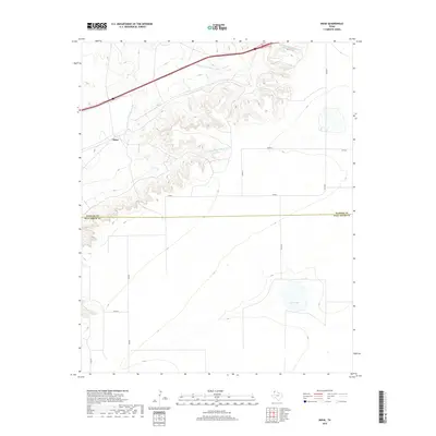
2019 Map of Boise
USGS Topo · Published 2019About this map
Boise sits at the heart of this High Plains landscape, where the flat cattle country is carved by the deep, winding drainages of the Mujares Creek system. This 2019 survey documents a sparsely populated ranching region defined by an extensive grid of county roads, such as Co Rd A and Co RD R, which navigate the elevation changes between the plateau and the creek beds. The drainage patterns of the E Strip E Fork Mujares Cr and W Strip E Fork Mujares Cr create a complex topography in the northern half of the quadrangle, contrasting with the level terrain to the south. Further south, the intermittent Hay Lake provides a notable hydrologic landmark in an otherwise dry environment. The map also delineates the jurisdictional boundary between Oldham County and Deaf Smith County, highlighting the remote character of this Texas Panhandle borderland.
Find a feature on this map
13 named features on this map. Tap any name to fly to it.
Don’t see what you’re looking for? This feature index may not catch every label — zoom into the map to look around manually.
Map Details
Editions of this 2019 Boise Map
This is the sole edition of this map. No revisions or reprints were ever made.
Other maps of this area

1954 · Tucumcari
USGS Topo · 1:250,000

1958 · Tucumcari
USGS Topo · 1:250,000

1966 · Moser Ranch
USGS Topo · 1:24,000

1966 · Signal Spring
USGS Topo · 1:24,000

1966 · Boise
USGS Topo · 1:24,000

1966 · Simms NW
USGS Topo · 1:24,000

1966 · Simms
USGS Topo · 1:24,000

1966 · Adrian
USGS Topo · 1:24,000

1966 · Signal Spring SE
USGS Topo · 1:24,000

1966 · Sand Point
USGS Topo · 1:24,000