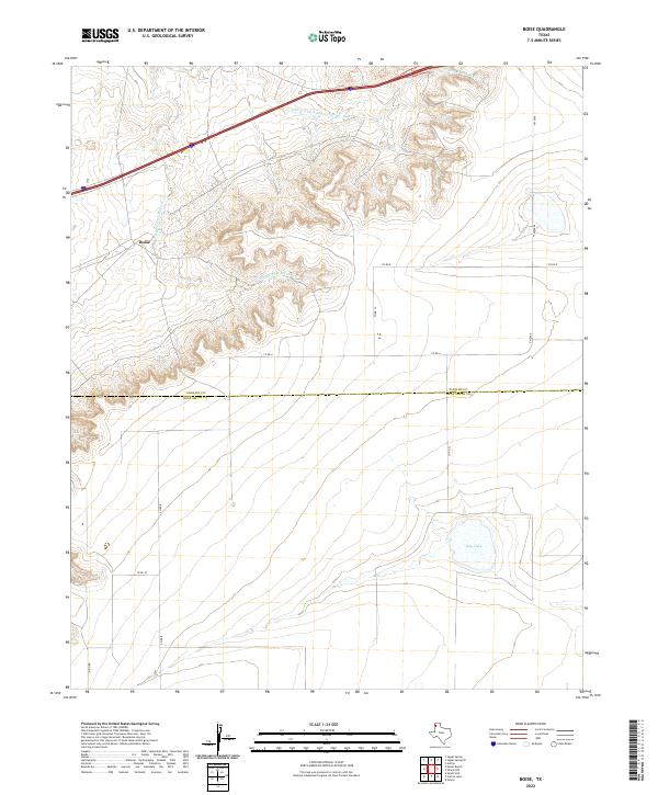
2022 Map of Boise
USGS Topo · Published 2022About this map
Boise serves as the central focal point of this high plains landscape, situated near the headwaters of the Mujares Creek system. The topography is defined by the intricate erosion patterns of E Strip E Fork Mujares Cr and W Strip E Fork Mujares Cr, which carve deep draws through the otherwise level panhandle terrain. This 2022 survey illustrates the transition from the rugged drainage breaks in the north to the flatter agricultural and grazing lands to the south.
Find a feature on this map
13 named features on this map. Tap any name to fly to it.
Don’t see what you’re looking for? This feature index may not catch every label — zoom into the map to look around manually.
Map Details
Editions of this 2022 Boise Map
This is the sole edition of this map. No revisions or reprints were ever made.
Other maps of this area

1954 · Tucumcari
USGS Topo · 1:250,000

1958 · Tucumcari
USGS Topo · 1:250,000

1966 · Moser Ranch
USGS Topo · 1:24,000

1966 · Signal Spring
USGS Topo · 1:24,000

1966 · Boise
USGS Topo · 1:24,000

1966 · Simms NW
USGS Topo · 1:24,000

1966 · Simms
USGS Topo · 1:24,000

1966 · Adrian
USGS Topo · 1:24,000

1966 · Signal Spring SE
USGS Topo · 1:24,000

1966 · Sand Point
USGS Topo · 1:24,000