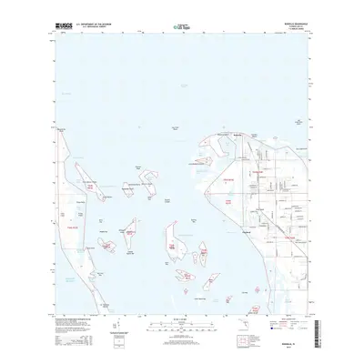
2015 Map of Bokeelia
USGS Topo · Published 2015About this map
Pineland and Bokeelia anchor the northern reaches of Pine Island, showcasing a landscape defined by the intricate waterways of Pine Island Sound and Charlotte Harbor. The settlement patterns here follow a dense network of residential streets such as Stringfellow Rd and Barrancas Ave, while the surrounding waters are dotted with numerous small keys and islands. Notable archaeological and historical sites are evident in the presence of Howard Mound and Faulkner Mound, suggesting a deep human history tied to these coastal estuaries.
Find a feature on this map
106 named features on this map. Tap any name to fly to it.
Don’t see what you’re looking for? This feature index may not catch every label — zoom into the map to look around manually.
Map Details
Editions of this 2015 Bokeelia Map
This is the sole edition of this map. No revisions or reprints were ever made.
Other maps of this area

1956 · Punta Gorda SE
USGS Topo · 1:24,000

1956 · Tampa
USGS Topo · 1:250,000

1956 · Charlotte Harbor
USGS Topo · 1:250,000

1957 · Punta Gorda SW
USGS Topo · 1:24,000

1957 · Placida
USGS Topo · 1:24,000

1958 · Matlacha
USGS Topo · 1:24,000

1958 · Captiva
USGS Topo · 1:24,000

1958 · Port Boca Grande
USGS Topo · 1:24,000

1958 · Pine Island Center
USGS Topo · 1:24,000

1958 · Bokeelia
USGS Topo · 1:24,000