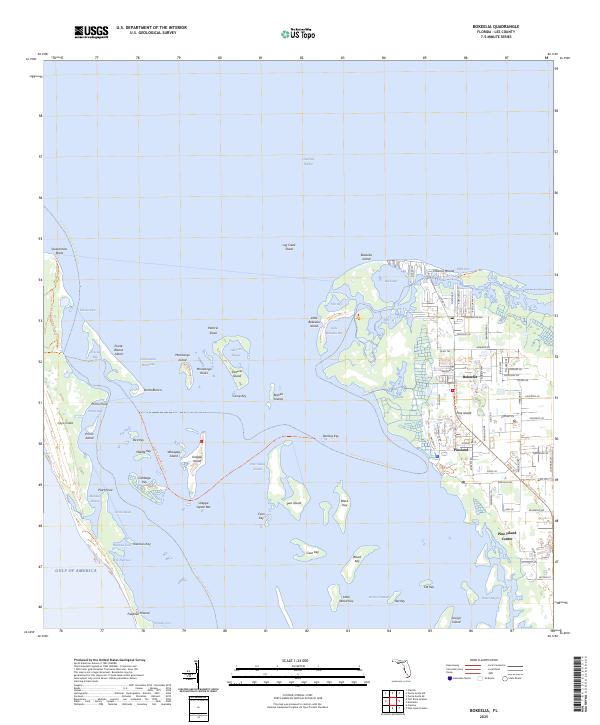
2025 Map of Bokeelia
USGS Topo · Published 2025About this map
Pine Island dominates this coastal survey, where the northern settlements of Bokeelia and Pineland are connected by the Stringfellow Road Trl. The landscape is a complex network of barrier islands and shallow sounds, including the protected lands of Cayo Costa State Park to the west. Between the main island and the Gulf of Mexico, the Intracoastal Waterway threads through Pine Island Sound, passing legendary locales like Cabbage Key and Useppa Island.
Find a feature on this map
102 named features on this map. Tap any name to fly to it.
Don’t see what you’re looking for? This feature index may not catch every label — zoom into the map to look around manually.
Map Details
Editions of this 2025 Bokeelia Map
This is the sole edition of this map. No revisions or reprints were ever made.
Other maps of this area

1956 · Punta Gorda SE
USGS Topo · 1:24,000

1956 · Tampa
USGS Topo · 1:250,000

1956 · Charlotte Harbor
USGS Topo · 1:250,000

1957 · Punta Gorda SW
USGS Topo · 1:24,000

1957 · Placida
USGS Topo · 1:24,000

1958 · Matlacha
USGS Topo · 1:24,000

1958 · Captiva
USGS Topo · 1:24,000

1958 · Port Boca Grande
USGS Topo · 1:24,000

1958 · Pine Island Center
USGS Topo · 1:24,000

1958 · Bokeelia
USGS Topo · 1:24,000